UK FIRM, MAYOR-TIC GLOBAL RESOURCES LTD TO PARTNER EKITI FOR STREET NAMING, HOUSE NUMBERING AND INTEGRATION WITH GOOGLE MAP


***The CEO, Ebenezer Ojo emphasised that the concept is also tailored to key into the agenda of Governor Biodun Oyebanji in the area of urban renewal as well as
infrastructural and Rural Development
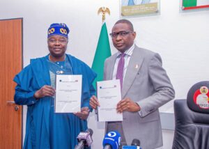
A UK-based firm, Mayor-Tic Global Resources Limited is working towards a partnership with Ekiti State Government to facilitate proper street naming and numbering across the state.
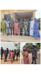
According to the Spokesperson of the outfit, Iyiola Adetola, the team had visited the state and has commenced talks with the officials of the state government with a view to showcasing the benefits of the project as being witnessed in other major cities in the country.
He said the Chief Executive Officer of the firm, Mr. Ebenezer Ojo who is also from Ado-Ekiti the state capital has carried out similar projects in some major cities in the country.
Speaking with newsmen in Ado-Ekiti, the Chief Executive Officer, Mr. Ebenezer Ojo said “Ekiti is a unique society with people of cultural heritage and religion diversity, the cultural context and heritage of a place is being considered when it comes to naming streets and buildings”.
“Streets naming are used to honour our past and present heroes, elders, politicians, philanthropists, sports men and women, those who have contributed meaningfully to the development of a place”.
Ojo emphasised that the concept is also tailored to key into the agenda of Governor Biodun Oyebanji in the area of urban renewal as well as
infrastructural and Rural Development.
The CEO explained that the project would start with Ado-Ekiti street naming, house numbering, address system and integration with google map with live traffic updates.
“When you start a trip on Google Maps, and you choose your destination using a motorcycle, road public transportation, or a car, Goggle Maps show you live traffic updates.”
“These updates can/direct you on what routes and alternatives can help take
you destination faster, accounting for traffic lights and traffic conditions. In fact, the total trip time is adjusted in real-time based on what the traffic situation looks like.”
“This technology works using a combination of high-res satellite Imagery, GPS signals, and geographic information systems data”, The Chief Executive Officer added.

